
If you're going to Mount Graham, about nine miles south of Safford, remember a few things.
 Wait until spring. Graham, the highest peak in Southern Arizona and the anchor of the Pinaleño Mountains, rises almost 10,720 feet. It gets cold. Besides, higher-elevation campgrounds just closed for the winter this week, and that's where we had the most fun.
Know where you're going. Don't be idiots like a certain blogger and her husband, and punch in the
 coordinates on your GPS. Don't feel smug and satisfied because you punched in the exact geographical coordinates, so it's not like anything could go wrong. Not that I know anything about that.
Keep an eye out for wildlife. Be safe, but mostly, keep an eye out because it's awesome and there's a lot of it to see here.
Remember to bring your directions. And seriously, don't rely on your GPS.
Plan for inclement weather. Tarps, extra layers, more tarps, coats. It's a pain, but trust me, it's worse to leave them behind.
If you make a campfire, keep it to the fire circles, and thoroughly douse and bury it afterward.
For the love of god, don't use your GPS to get there. And if you do, and something goes wrong, remember -- it's your spouse's fault.
We were lucky the weekend we went to Mount Graham, as even the busiest campsites still had plenty of room. You probably should call the number listed here to check availability before you head out, but something is bound to be open. If you're headed out that way, you want to take US 191 to AZ 366, which winds up the mountain.
Don't try and get fancy with directions. Bring them, and trust yourself and don't take any weird turns suggested by your GPS. Our own drive out there was nothing short of disastrous. After realizing we didn't have the directions ("I thought you brought them!") my husband and I nevertheless felt confident, because we had the precise geographical coordinates. Surely putting those into the GPS would steer us better than some stupid website, or the fact that we basically knew where to go already.
 More directly, maybe. What we didn't know, however, was that the GPS was hell-bent on steering us directly to the mountain, serviceable roads be damned. By the time we were in over our head, we had already driven for ten miles on washboards and eroded dirt roads, and we figured pushing on just a bit more would be better than redoing all of that, so we got ourselves in even deeper, and probably almost on some really dumb evening news piece about idiot motorists.
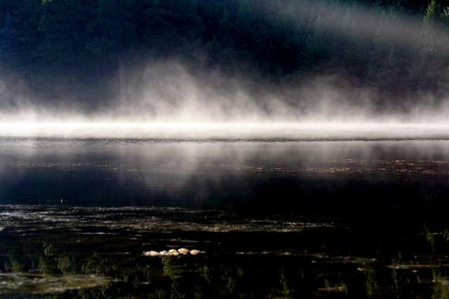 To make an extremely long story shorter, after what might as well have been off-roading (in my PT Cruiser) somewhere between Klondyke and Safford for a couple of hours, we nearly drove off a high wash wall. We turned around, took an extensive series of roads to backtrack, and found ourselves ... at the same damn wash. Finally, we managed to escape the nameless network of rocky paths, and eventually rediscovered the 366.
 After that, the trip was nothing but awesome. The crazily switchbacking drive to the summit presents new and spectacular views at each turn, and we could actually feel the temperature change as we ascended, dropping about 40 degrees from the base to our campground at 8,600 feet.
We picked Riggs Flat Campground, because 1) it was a higher-elevation sight, the better for chilly weather and dramatic views; and 2) it has a lake. It's actually one of the more popular campgrounds on the mountain, so you might want to check ahead for availability.
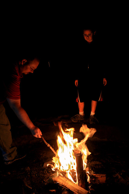
 Obviously with our driving misadventures, we got to the campsite a little later than we'd planned. Still, we had time to unpack, roam around for an hour, and start a roaring campfire for marshmallow roasting and general campiness. After consuming enough S'mores to make us all nauseated, we doused and buried the fire, and just as we began to worry about stray embers, a deluge began pouring from the sky, and we turned in for the night. (Thankfully, our weather preparations were much more thorough than our direction-bringing preparations.)
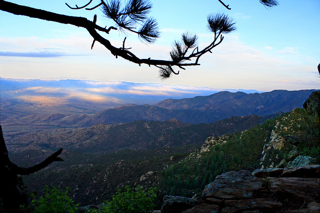
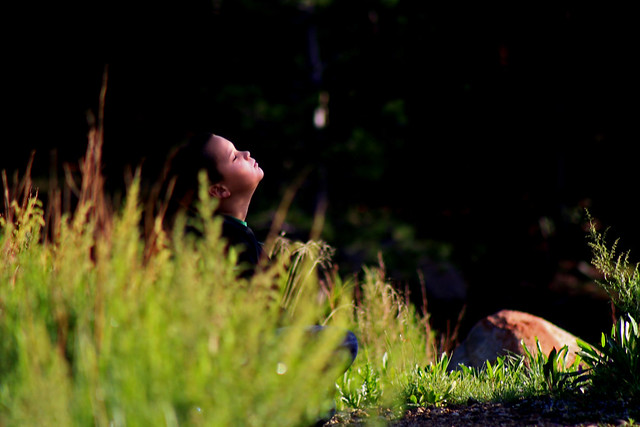
 The next morning was sublime. It was like the rain had rinsed the whole world. I watched in the five minutes before anyone else awoke, as the forest glowed blue through dawn's sliver of light and someone's campfire smoke. Soon sharp, bright, clear sunlight woke up my son and husband. We grabbed some slightly smooshed sandwiches, hiked a short trail, and sat on the cliff, eating peanut butter and jelly and watching the world unfold beneath our feet. Pretty sweet payoff for a short morning hike.
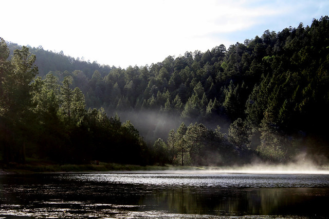
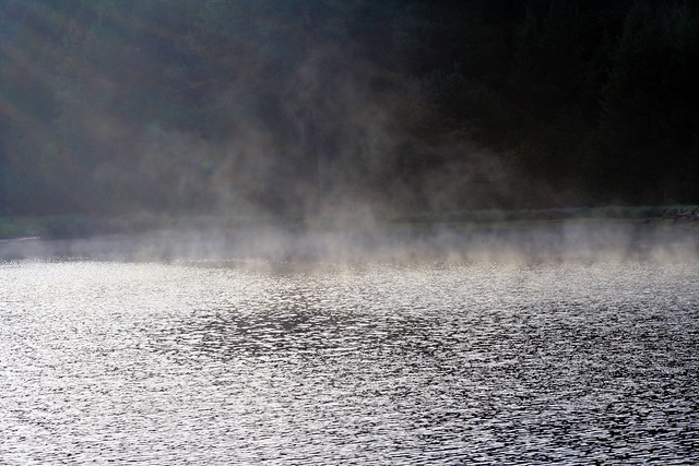
We returned to the campsite and spent the rest of the morning at the lake. Mist rolled over the water as a few anglers set up for the day (rainbow, brown, and brook trout are stocked) We traipsed haphazardly between the lakeside and nearby forests and meadows.
 We hiked various numerous trails throughout the rest of the day -- trails through spruce and fir and through ponderosa pine, easy walks through open grassy meadows, meandering paths along creeks. We saw butterflies, frogs, sharp-shinned hawks, Cooper's hawks, Coue's white-tailed deer, wild turkeys, several species of lizard, and more. We smelled a skunk, which made my son absurdly happy, and found black bear scat, which made him even happier. All in all, a pretty great trip.
Just don't use your damn GPS.


0 comments:
Post a Comment